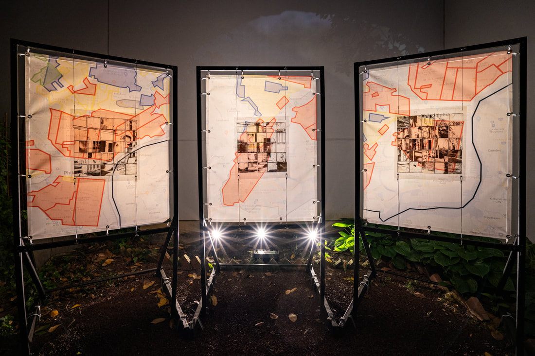
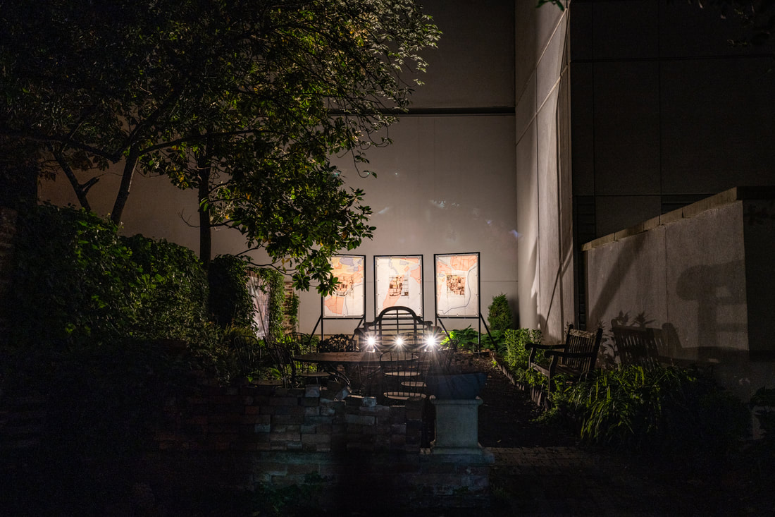
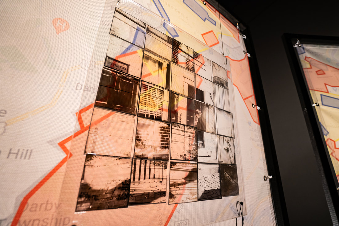
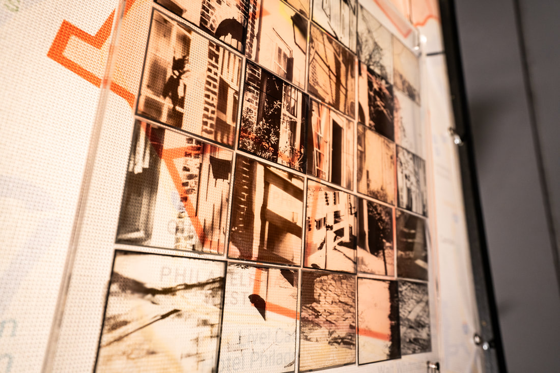
HOUSE # 135, 2022
(20th-Century Stories)
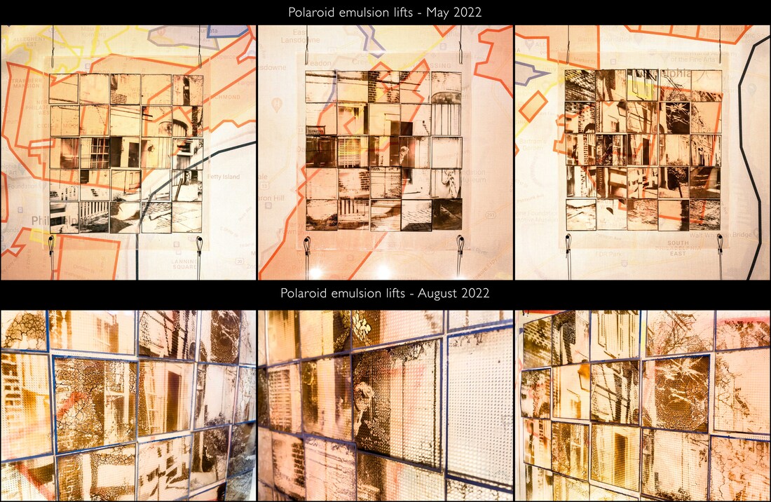
|
In collaboration with Jim Hadfield (b. 1961).
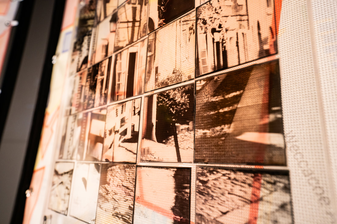
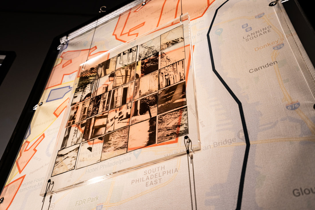
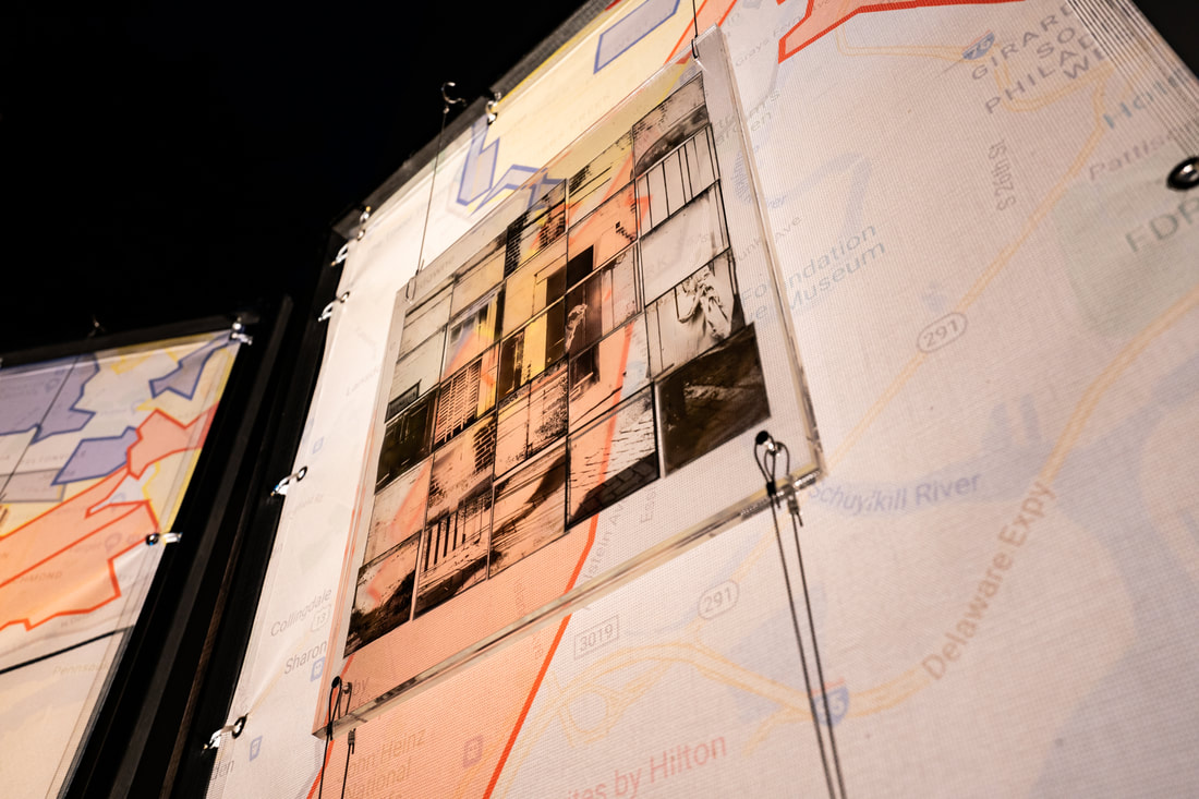
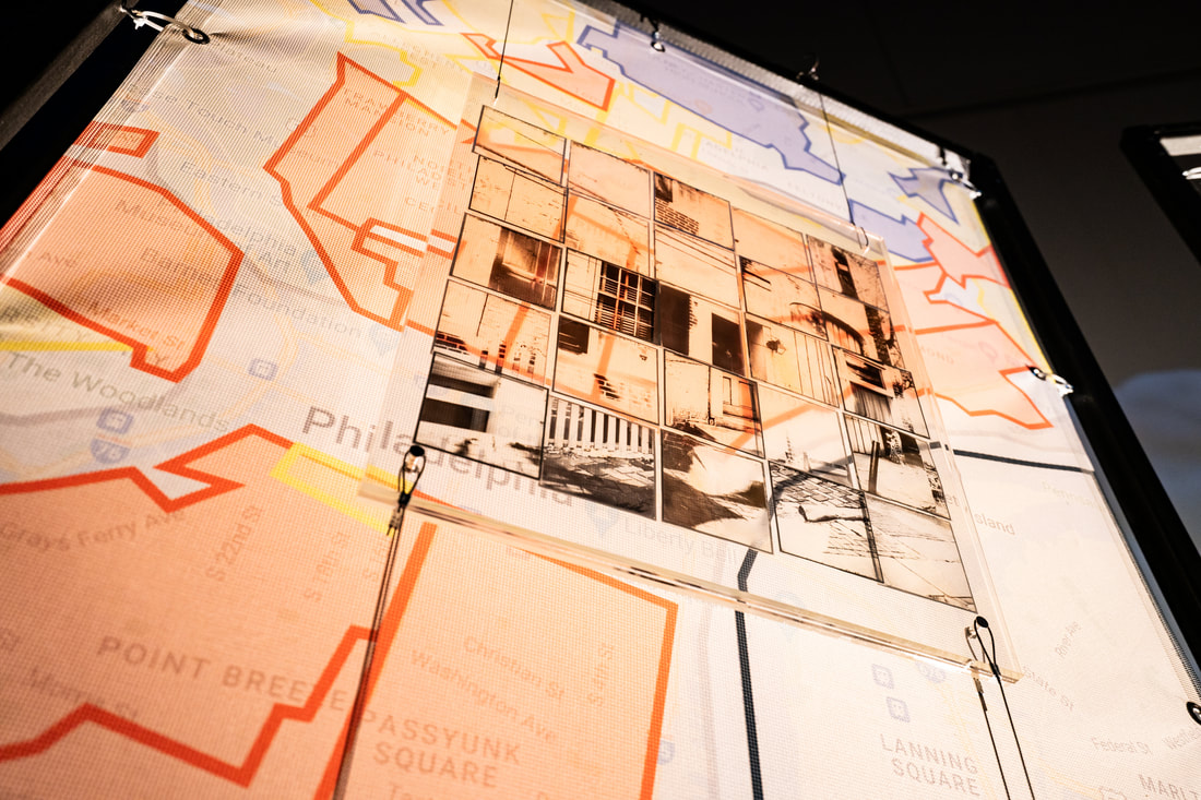
Polaroid transparencies on acrylic layers and mesh banners. Dimensions: Structure - 7ft x 12 ft. Transparencies - 17.5" x 20" inches. Housing in Philadelphia changed around the turn of the 20th century. How city neighborhoods were labeled is tied to the priorities of those with power, privilege, and speculative financial investment in those neighborhoods. These labels often determine the options available to those without power and privilege who lived and worked in these spaces. For example, Brewer's 1934 rating map of Philadelphia shows red areas that indicate majority-Black neighborhoods (redlining). In 1930, three Black families lived in House # 135 Elfreth's Alley. There are no archival images from this time showing any of these families. They probably lived in a sense of isolation, surrounded by exclusively white neighbors. The three pictures suspended on the frames are rephotography experimentations from House # 135 (1930, 1952, the 1970s, 2022), where rainwater, dust, sun, and temperature continue modifying the images. Ephemerality, transition, and decaying reflect these racial inequalities in the distribution of the city and how we must deal with the consequences of those policies. For more information, listen to the Alley Cast. Episode 6: Urban "Decay" and the City of Homes. |